Maps
Soil Types
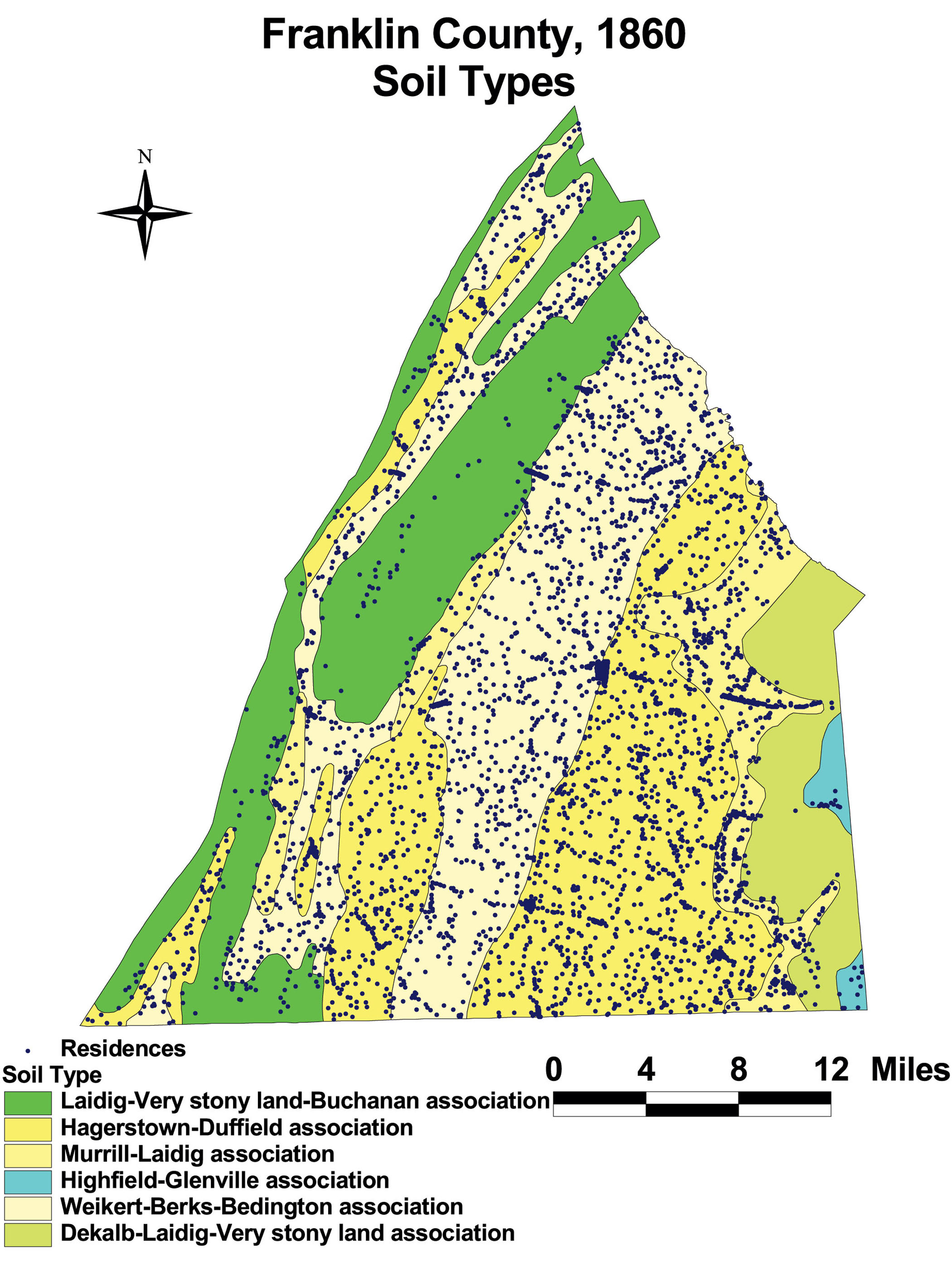
This map of Franklin County shows the soil types in the county. Residents in Franklin concentrated their development on the best soils, though Franklin’s population density forced residents to inhabit a wide array of soil types. This map also effectively shows the dense concentration of residences along the major roads in the county.
The map is based on GIS data and soil type data derived from a 1978 U.S. Geological Survey soil map. The map is derived from a D.H. Davison map of Franklin County, published in 1858. The Davison map has been georeferenced at the Virginia Center for Digital History, using ESRI Arc Info to produce a Geographic Information Systems map and database of households.