Maps
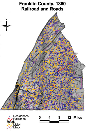
Railroads and Roads, 1860
This map of Franklin County shows the densely built transportation infrastructure, including railroads, major roads, and minor roads. Nearly all residences clustered along major and minor roads. Only a handful of residents lived off of a road.
The map is based on GIS data and soil type data derived from a 1978 U.S. Geological Survey soil map. The map is derived from a D.H. Davison map of Franklin County, published in 1858. The Davison map has been georeferenced at the Virginia Center for Digital History, using ESRI Arc Info to produce a Geographic Information Systems map and database of households.