Maps
Railroads and Roads, 1860
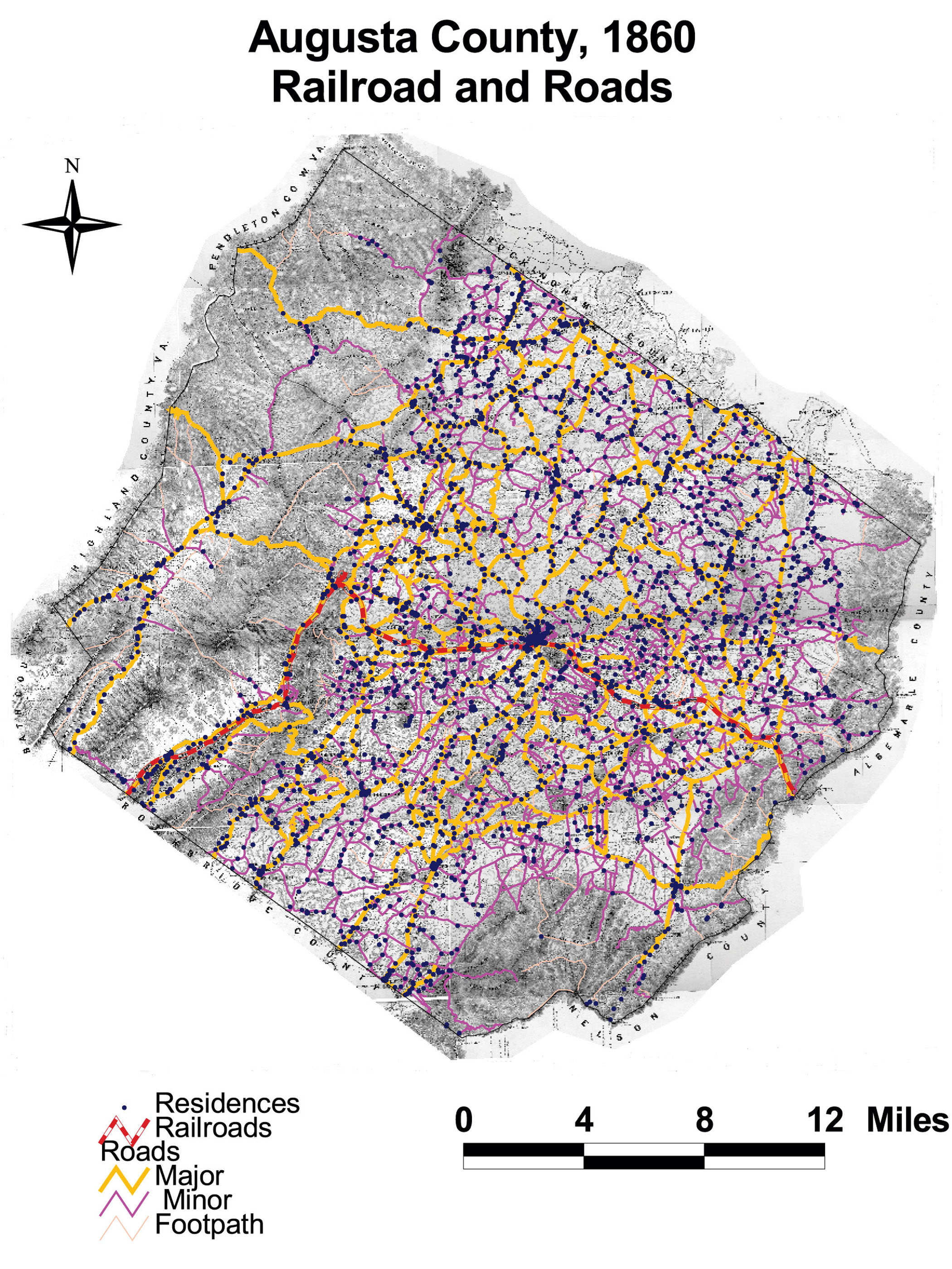
This map of Augusta County shows the densely built transportation infrastructure of railroads, major roads, minor roads, and footpaths. Residences clustered tightly and uniformly along major and minor roads in the county. Only a handful of residents lived off of the road network.
The map is derived from a Jedediah Hotchkiss map of Augusta County, published in 1870 and based on surveys completed “during the war.” The Hotchkiss map has been georeferenced at the Virginia Center for Digital History, using ESRI Arc Info to produce a Geographic Information Systems map and database of households.