Maps
Churches and Schools, 1860
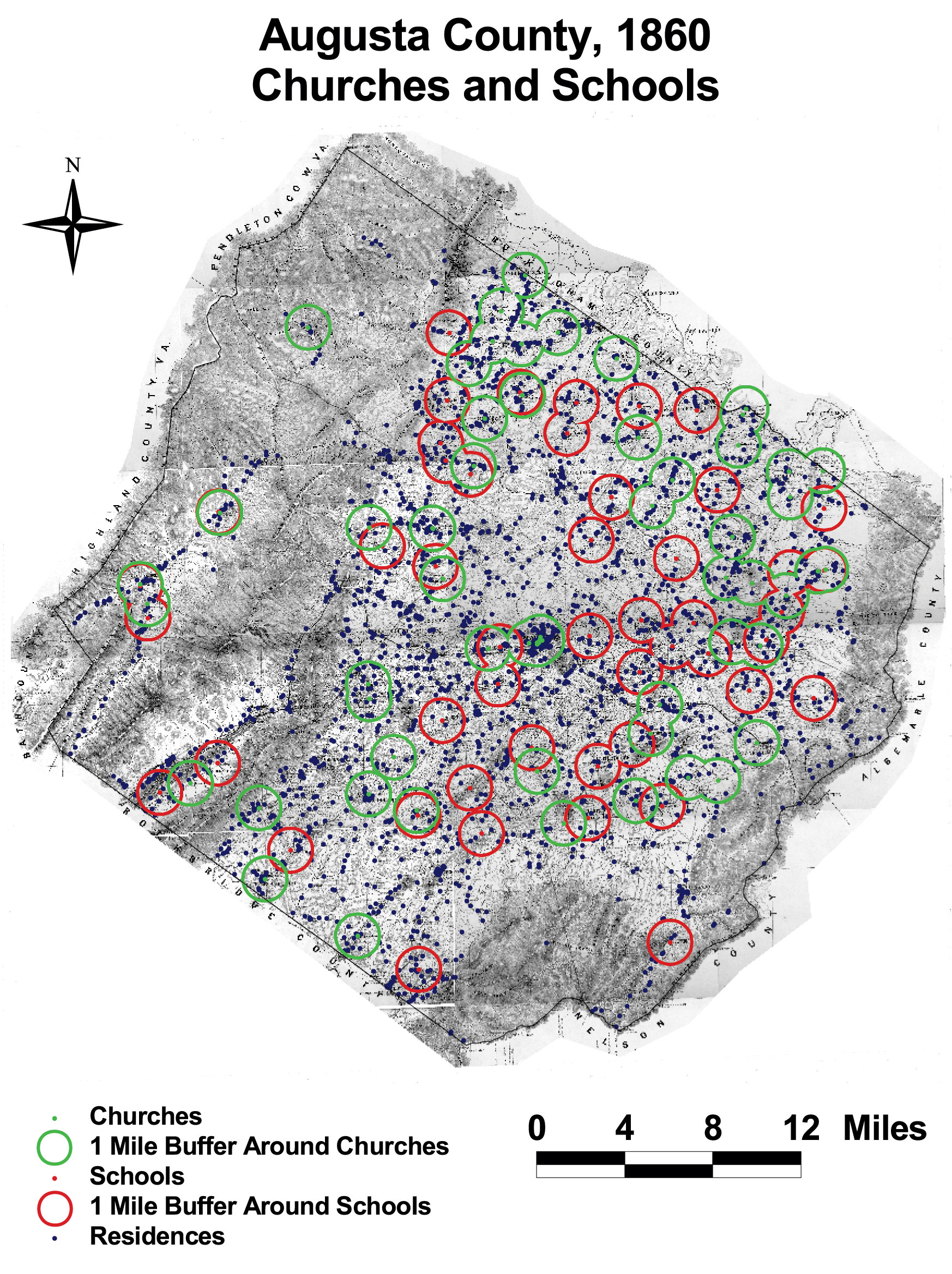
This map of Augusta County, Virginia shows the density of churches and schools in the county. The circles indicate a 1-mile radius around each institution. No residence in Augusta was more than 5.5 miles from a school or church.
The map is derived from a Jedediah Hotchkiss map of Augusta County, published in 1870 and based on surveys completed “during the war.” The Hotchkiss map has been georeferenced at the Virginia Center for Digital History, using ESRI Arc Info to produce a Geographic Information Systems map and database of households.