Maps
Agricultural Production by Precinct, 1860
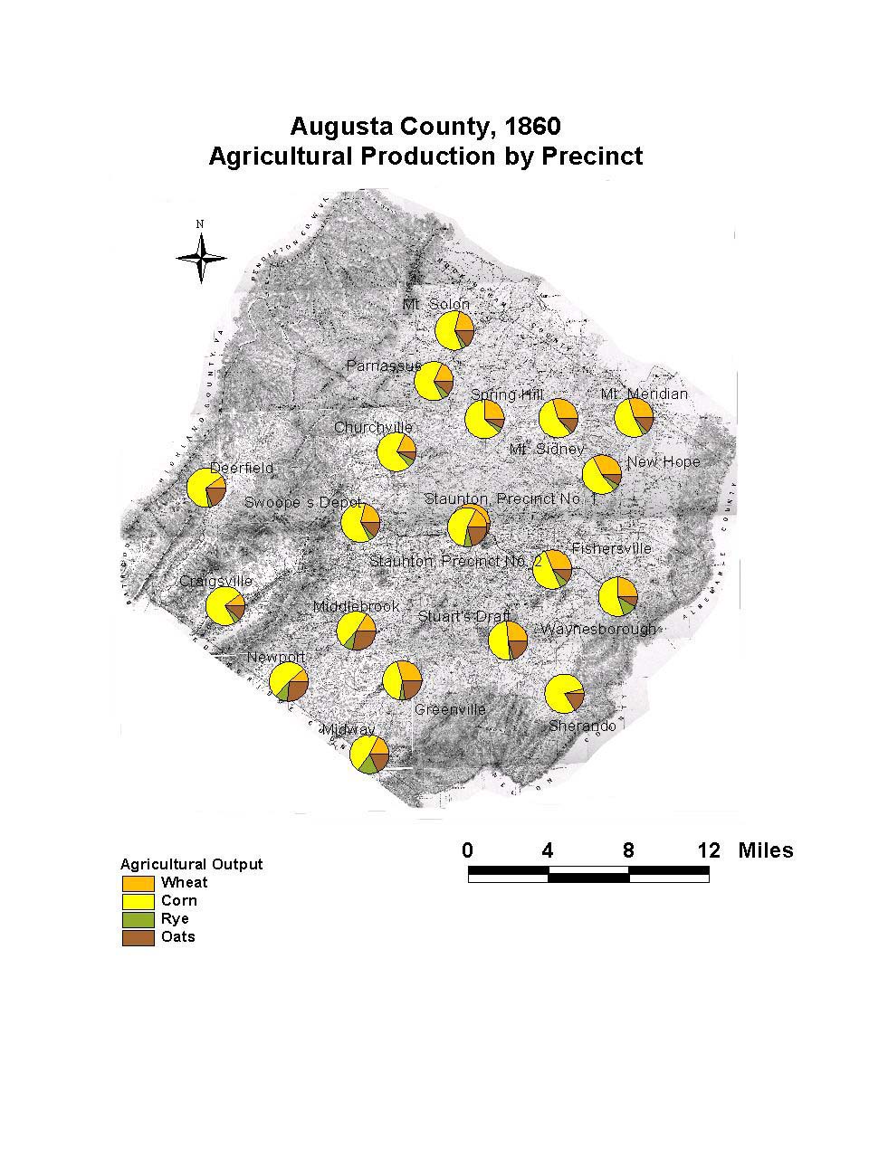
This map of Augusta County, Virginia, shows the agricultural production in the county in each voting precinct. The largest plantations in the county correspond to the areas of highest wheat production: the precincts of New Hope, Mt. Sidney, Fishersville, and Stuart’s Draft.
The map is derived from a Jedediah Hotchkiss map of Augusta County, published in 1870 and based on surveys completed “during the war.” The Hotchkiss map has been georeferenced at the Virginia Center for Digital History, using ESRI Arc Info to produce a Geographic Information Systems map and database of households.
Note: Original precinct boundaries are not available. Precinct boundaries were established in the GIS using Thiessen polygons around precinct stations as central places.