War and Peace in a 1920s Chambersburg Souvenir
A Franklin County sender mailed this souvenir viewfolder, containing 22 colorized photographs of Chambersburg scenes, to a California recipient in 1921. Revealing little about the Civil War at first glance, the number and subjects of the views in this folder, taken together, actually offer a unique estimate of the degree to which the war’s collective memory composed Chambersburg’s self-image in the early twentieth-century. This section presents the complete viewfolder, showing the proportion of photographs related to the Civil War to those unrelated to that conflict.
The Viewfolder
Viewfolders opened accordion-style, like postcard folders, but were intended for mailing as a complete package of double-sided picture cards—with the address on the package’s back cover—not as individual, single-picture postcards.
Ruth Sollenberger of Franklin County mailed this souvenir viewfolder, containing 22 colorized photographs of Chambersburg, PA, to Paul K. Lyttle of Upland, California, in 1921.
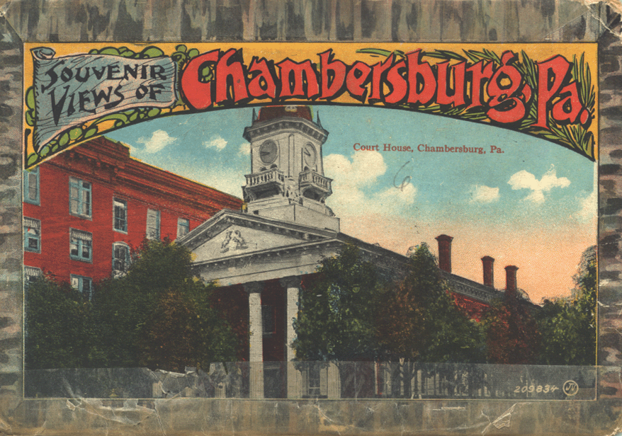
Front cover of viewfolder.
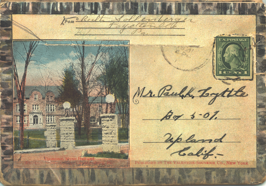
Back cover of viewfolder.
In sending the viewfolder, Ruth scribbled a personal note to Paul:
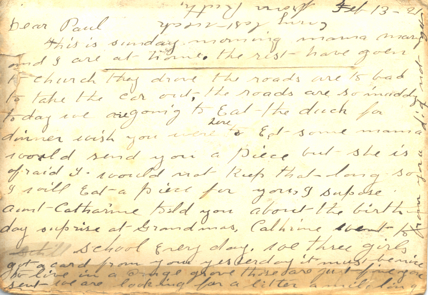
Feb 13-[19]21 Dear Paul This is sunday morning mama mary and I are at home. the rest have goen to church they drove the roads are [to?] bad to take the car out. The roads are so muddy today we are going to Eat the duck for dinner wish you were here to eat some mama would send you a piece but she is afraid it would not keep that long so I will eat a piece for you. I supose aunt Catharine told you about the birthday surprise at Grandmas. Catharine went to schill school every day. we three girls got a card from you yesterday it must be nice to live in a orange grove those are just fine you [sent?] we are looking for a l[et?]ter a mile long from you did not get [any?] last weak from Ruth.
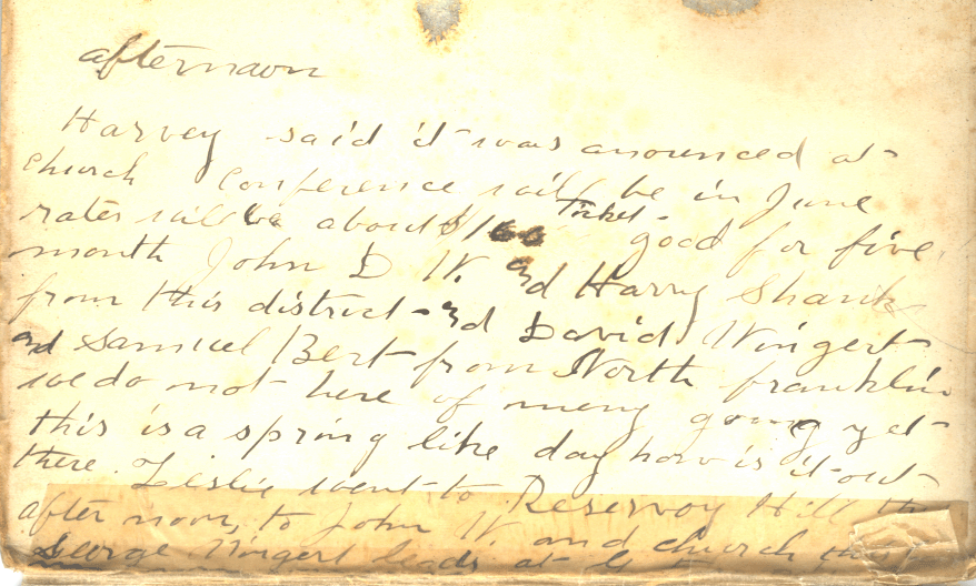
afternoon Harvey said it was announced at church conference will be in June rates will be about $1[60?] ticket good for five month John D[.]W. and Harry Shank from this district--[3?]d David Wingert and Samuel Bert from North franklin we do not here of many going yet this is a spring like day how is it out there. Leslie went to Reservoy Hill this after noon, to John W. and church this [?] George Wingert leads at [?]
Franklin County’s Civil War in the Viewfolder
Revealing little about the Civil War at first glance, the number and subjects of the pictures in the viewfolder, taken together, offer a unique estimate of the degree to which the war’s collective memory composed Chambersburg’s self-image in the early twentieth-century. Of the viewfolder’s 22 pictures, three featured the Diamond’s memorial and other structures commemorating the Civil War, while two additional pictures portrayed intact or ruined buildings that attested to the severity of wartime destruction.
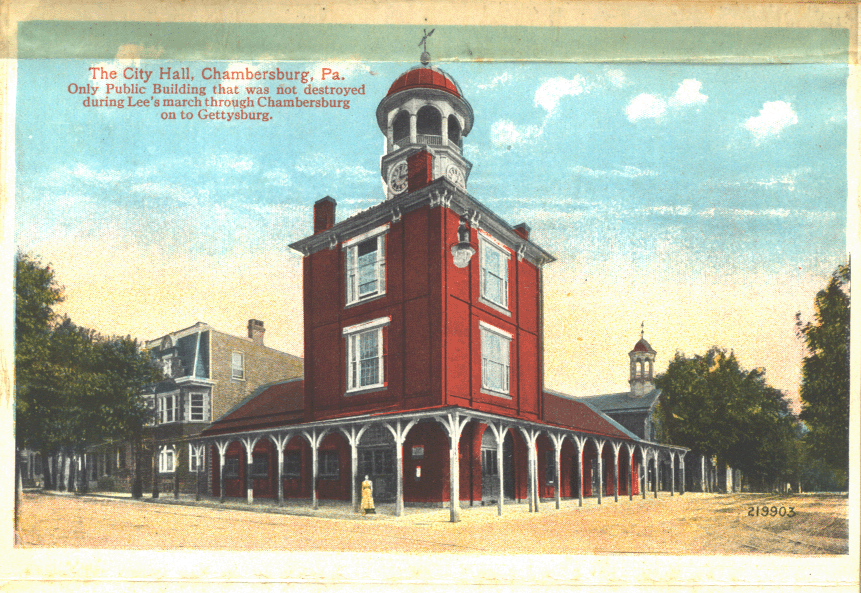
The City Hall, Chambersburg, Pa. Only Public Building that was not destroyed during Lee’s march through Chambersburg on to Gettysburg.
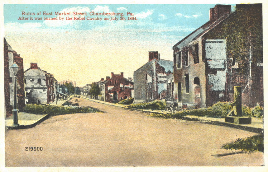
Ruins of East Market Street, Chambersburg, Pa. After it was burned by the Rebel Cavalry on July 30, 1864.
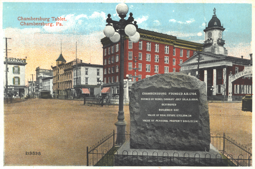
Chambersburg Tablet, Chambersburg, Pa. (This tablet commemorated the burning of Chambersburg by the Confederates.)
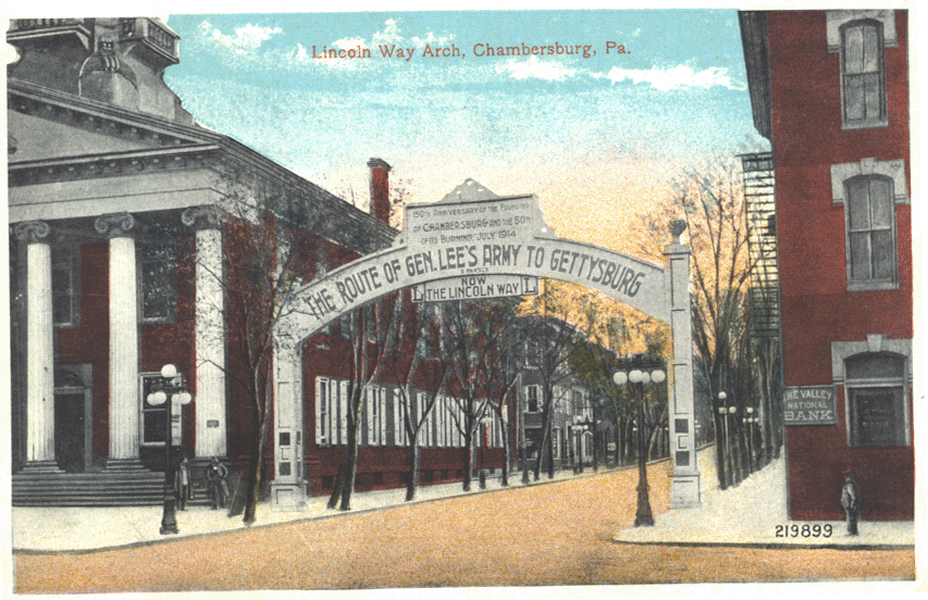
Lincoln Way Arch, Chambersburg, Pa.
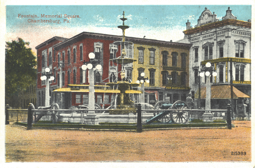
Fountain, Memorial Square, Chambersburg, Pa.
“Ruins of East Market Street”
The burned-out buildings represented in “Ruins of East Market Street” were, in fact, long gone by the 1920’s. The picture from the viewfolder is actually an artist’s adaptation of a photograph showing Chambersburg during the Civil War.
Shortly after Southern troops had departed fire-ravaged Chambersburg in 1864, Northern photographers arrived and recorded its ruins on more than two dozen different negatives. From these, they soon manufactured and sold photographic prints. The editors of Harper’s Weekly, an illustrated newspaper, were early purchasers of the images. The Harper’s issue of August 20, 1864, carried engraved adaptations of three of the photographs, one of which was the “Ruins of East Market Street”:
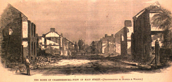
The <i>Harper’s</i> version of the street.
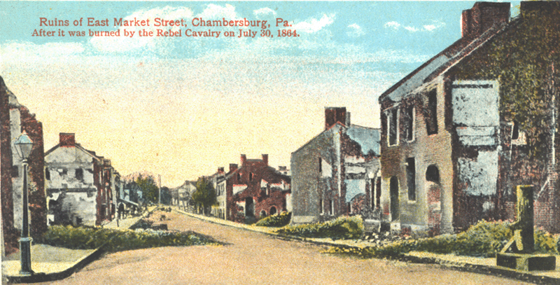
The viewfolder’s version of the street.
Note the subtle differences, including the identification of the street name, between the Harper’s version of the wartime photograph (left) and the viewfolder’s version (right).
“Lincoln Way Arch”
Dedicated in 1914, the arch stood on one side of the Diamond in downtown Chambersburg. While the smaller lettering on the arch served lesser functions, such as commemorating the 100-year anniversary of Chambersburg’s founding and helping publicize the Lincoln Highway, or “Lincoln Way,” the arch’s largest lettering denoted its principal function: marking the route that Confederate General Robert E. Lee and part of his Army of Northern Virginia followed towards Gettysburg.
The Harper’s version of the street.
The viewfolder’s version of the street.
The motivation for erecting the arch was probably more economic than commemorative. A year before its dedication, President Woodrow Wilson had presented a speech at Gettysburg and reinforced that battlefield’s status as the nation’s premiere Civil War attraction. The arch in Chambersburg claimed a piece of the mammoth tourism pie that was Gettysburg by subtly redefining the battle as a campaign whose participants passed through locales not limited to Gettysburg and its immediate environs. The arch no longer stands.
Other Views of Chambersburg in the Viewfolder
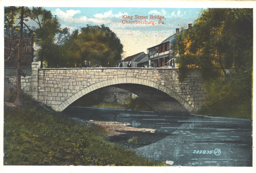
King Street Bridge, Chambersburg, Pa.
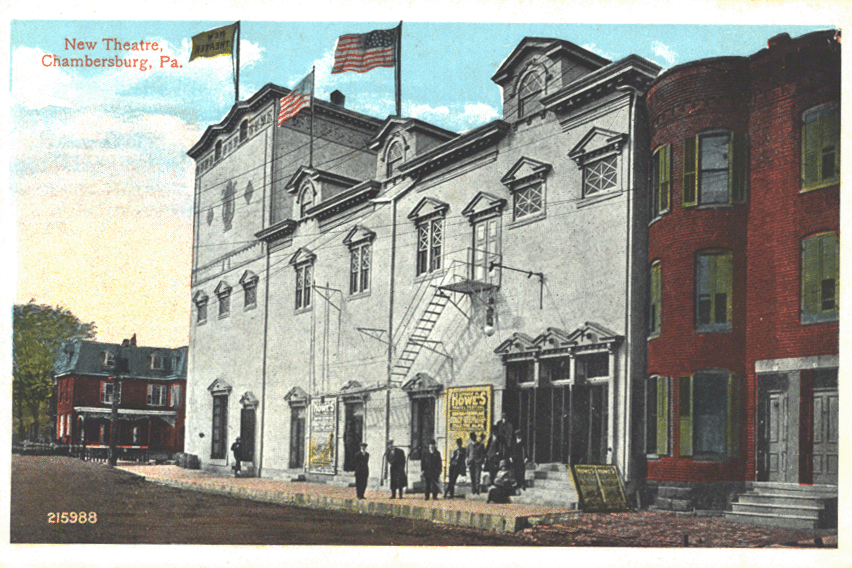
New Theatre, Chambersburg, Pa.
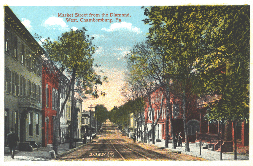
Market Street from the Diamond, West, Chambersburg, Pa.
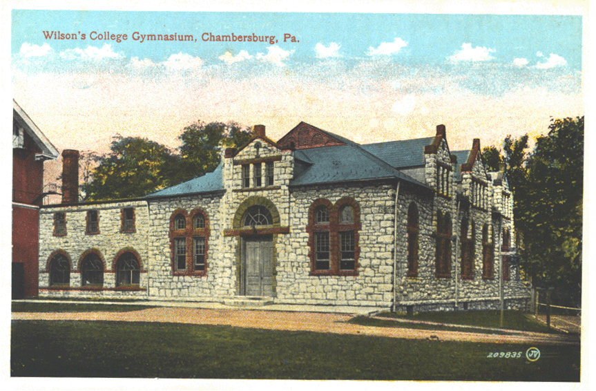
Wilson’s College Gymnasium, Chambersburg, Pa.
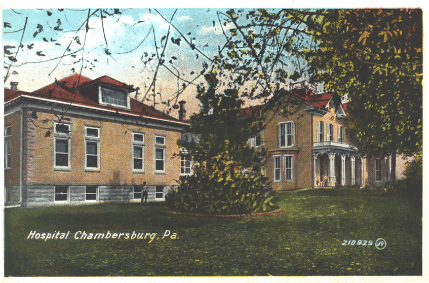
Hospital Chambersburg, Pa.
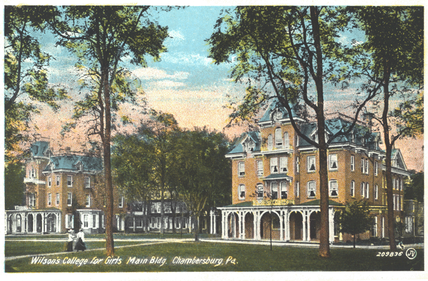
Wilson’s College for Girls Main Bldg. Chambersburg, Pa.
![C[umberland] V[alley Railroad] Passenger Station, Chambersburg, Pa.](/img/chapters/memories_of_war/franklin/war-peace/diamondviewfolder9.gif)
C[umberland] V[alley Railroad] Passenger Station, Chambersburg, Pa.
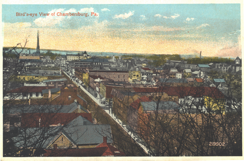
Bird’s-eye View of Chambersburg, Pa.
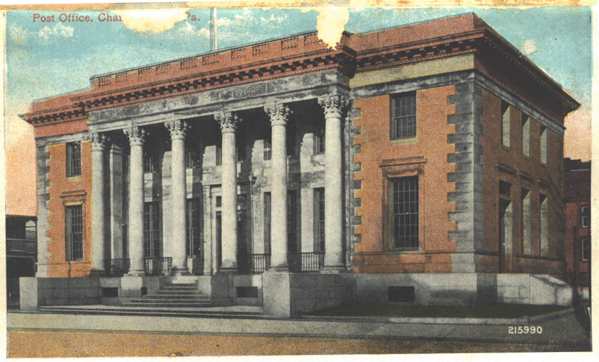
Post Office, Chambersburg, Pa.
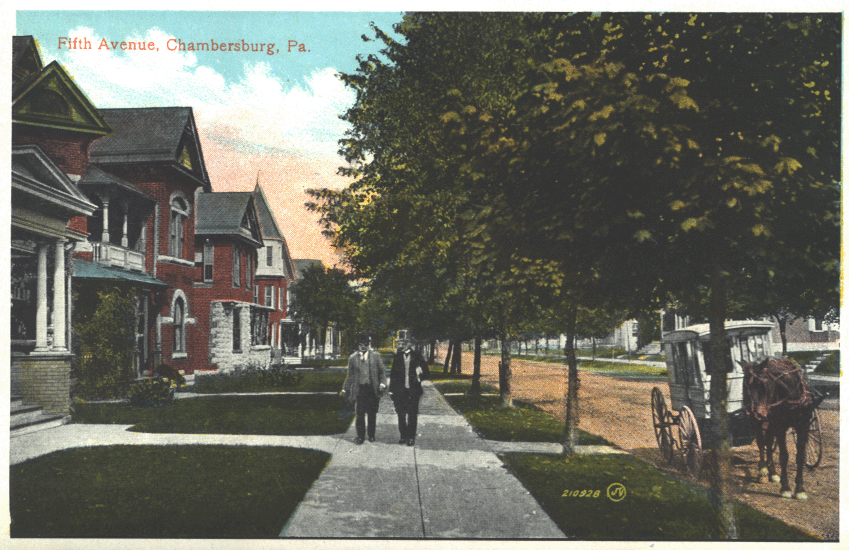
Fifth Avenue, Chambersburg, Pa.
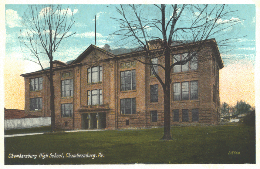
Chambersburg High School, Chambersburg, Pa.
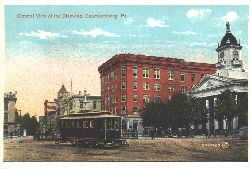
General View of the Diamond, Chambersburg, Pa.
![First U[nited] B[retheren] Church and Parsonage, Chambersburg, Pa.](/img/chapters/memories_of_war/franklin/war-peace/diamondviewfolder17.gif)
First U[nited] B[retheren] Church and Parsonage, Chambersburg, Pa.
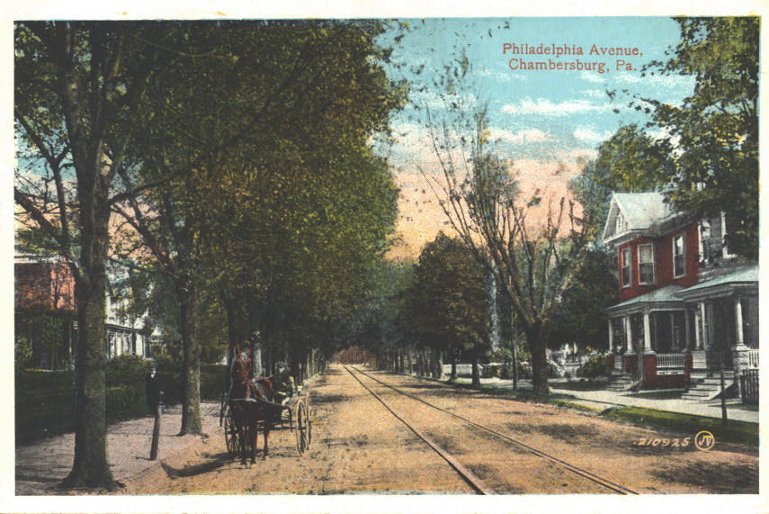
Philadelphia Avenue, Chambersburg, Pa.
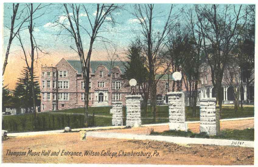
Thompson Music Hall and Entrance, Wilson College, Chambersburg, Pa.
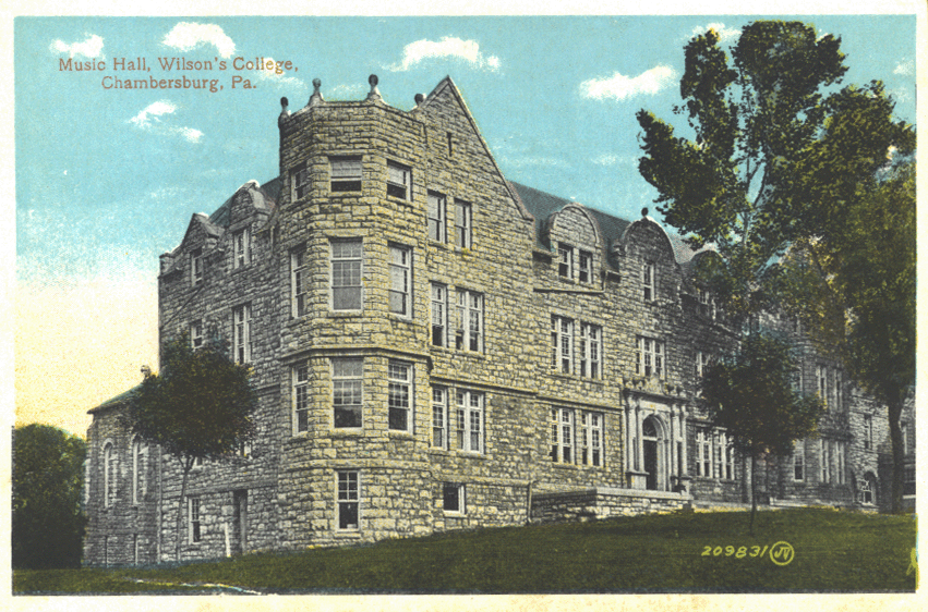
Music Hall, Wilson’s College, Chambersburg, Pa.
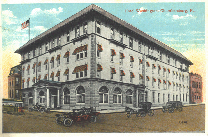
Hotel Washington, Chambersburg, Pa.